The Wright Way

The Wright Way

Tuesday, October 4, 2022

75 Before 75

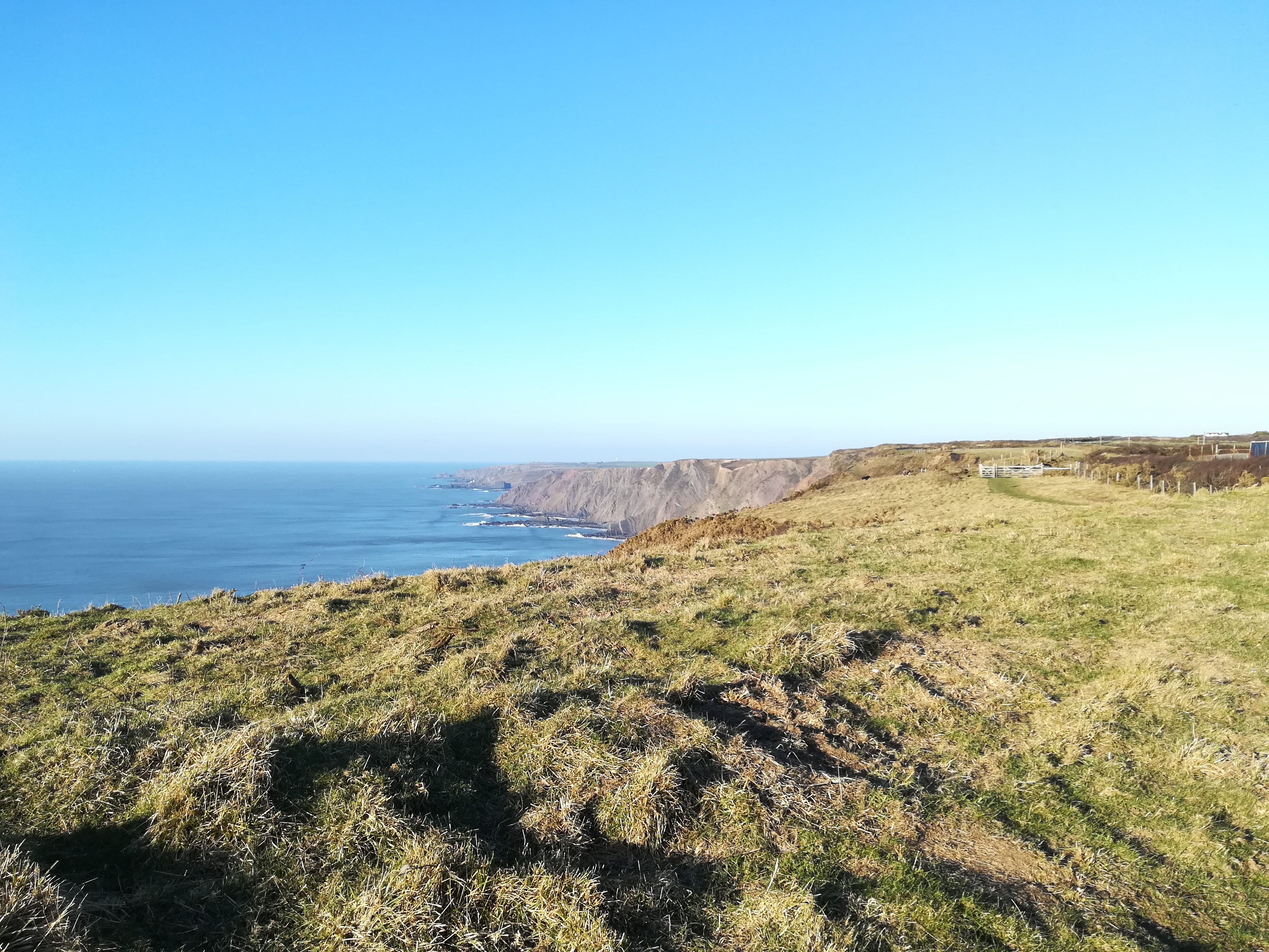
View towards Hartland Point


This autumn 2022 I am tackling our “unconquered” sections of the South West Coast Path between Hartland and Lands End. These total around 75 miles – and my partner, Helen, and I will be endeavouring to walk these sections before my 75th birthday at the end of November.

There are 8 “walking chunks” – which are as follows:-

1.    1. Hartland to Morwenstow                                              10
2. Widemouth Bay, Bude to Crackington Haven                 6
3. Nr Pentire Point to Polzeath then Rock                         7.5 (circular)
4.  Mawgan Porth to Newquay        1st Oct                   7 
5.  Perranporth to Trevaunance Cove   2nd Oct        10 (circular)
6.   Porthtowan to Portreath                                            6.5 (circular)
7.   Portreath to St Ives                      17/18 Sept        17
8.   St Ives to Cape Cornwall               2 days                   17

(Walks in green have now been completed)

The approximate mileage is shown against each section, and is around 81m with the circular elements included. These are where there are no reliable buses and we have to make the walk back to the starting points. The actual Coast Path mileage is just over 75.

PLANNING

We have 10 weekends in which to complete the challenge – starting 17th September and finishing on 27th November. This means that with the two shorter sections probably being done over one weekend, we should manage the remaining sections with time to spare.

Travel and the Walks

We plan to use bus journeys for either the ‘out run’ part of each walk, or the return to car base. The two shorter walks cannot use this facility so they will be circulars - making them longer! Car parking bases will be either at National Trust car parks (free) or Council P&D’s. Buses, particularly on Sundays, are less frequent and all too often some services are cancelled. This is why we take the choice most often of doing the bus journey TO our walking start point, and then we are walking back to the car.

Challenges

The biggest walking challenge is undoubtedly St Ives to Cape Cornwall. It is a section of nearly 18 miles and the ascent/descent profile of St Ives to Porthmeor (half way point) looks particularly tricky.
That said, we will be walking in autumnal weather rather than summer heat – although the underfoot conditions may not be that dry. All walks are on the Atlantic side of the Cornish Coast, and a small part of the North Devon Atlantic Coast.

I am dedicating this challenge to raise funds for Cancer Research. My Giving page is:-
https://fundraise.cancerresearchuk.org/page/peters-giving-page-635?proxy=page%2Fpeters-giving-page-635

Cape Cornwall


Tuesday, September 13, 2022

Tackling Whernside - the highest of the Yorkshire 3 Peaks


Whernside is a mountain in the Yorkshire Dales. It is the highest of the Yorkshire Three Peaks, the other two being Ingleborough and Pen-y-ghent.

My first climb of the Three Peaks was Pen-y-Ghent in autumn 2017 a couple of months before my 70th birthday, followed a year later by Ingleborough. After meeting Helen not long after the Ingleborough climb, and discovering she enjoyed walking, we started our lengthy odyssey of weekend walking on the South West Coast Path in Devon and Cornwall. 
Finally in autumn 2019 I persuaded her to join me in climbing Pen-y-Fan and Corn Du in the Brecon Beacons. 


Although Coast Path walks continued apace, we then had "the pandemic years" which put a severe brake upon completing the Yorkshire 3 Peaks. However - now that we have returned to more normal times in terms of lockdowns and restrictions - we've finally been able to get away together up to Yorkshire and complete the Three Peaks Challenge ... in 5 years!

So - what is there to know about Whernside at height 736m or 2385ft? 

Our climb started at 961ft near Ribblehead Viaduct on the Settle-Carlisle railway. 

In terms of height gain it was 1423ft. The steepest gradients on the descent was 41.1% and on the ascent 17.8%. The path up to the summit is a very long (4 mile) gradual climb - with the steepest gradients in the final 3/4 mile to the summit. 


And, with it being the highest Yorkshire Peak, the summit presented us with breathtaking views far and wide. 

Most noticeable at first were Ingleborough and Pen-y-Ghent - the other two of "The 3". Interestingly, seen from a higher place they didn't have anything like the dramatic visual effect they have from their own footings. 

Further afield we could see north towards the Lake District, across to the west with Morecambe Bay emerging from the haze, and many other dales and fells. 


We were blessed with amazing weather on this day. Earlier, whilst driving up from Settle, we noticed Ingleborough top was hidden by cloud - and I feared the worst for our Whernside climb!
However, the clouds evaporated and the sunshine took over bit by bit as we ascended.


Finally we knew it was time to start the journey down the mountain. I'd read a very good account online from someone who was well versed with all the climbs in the area, and I had something of a warning that the descent was much more of a challenge than the route up the mountain. 

We'd also heard from someone local that major repairs had been done to the pathway down, due to erosion. But at the start there was not much evidence of what we were about to encounter once the pathway you can see disappeared from view over the "descent horizon."

I started thinking back to my climb on Pen-y-Ghent, where I was blissfully unaware of descending via the "red route" that was something of an exhilarating scramble! "Please let it be manageable," my thoughts pleaded!


Thankfully, the universe provided us with a stern, yet stepped challenge which - as per my stats mentioned earlier - at 41% gradient in parts is still approaching a 1 in 2 incline. 
This takes a heavy toll on the knees in particular and we were to both feel the effects still several days later. My various forms of neoprene support from pelvis downward provided me with just enough strength and confidence to keep going for over 1.5 miles, whilst Helen by comparison seemed to almost skip down the large bouldered steps and then pause to look back and up at my measured descent
!


Upon a closer look at the picture left, you may be able to trace the line of the steep, rocky pathway zig-zagging back up the hill - as far as the eye can see. Neither Helen nor I took any pictures on this part of the walk - it was a matter of keeping good balance, looking where the next steps would be, and not wobbling in the wind. Oh look - I haven't mentioned the wind have I? As usual on mountains, particularly above 1500ft, the air moves in a different and more solid way!  


Relief came eventually as the climb down levelled out into crossing fields and walking down lanes towards, and then under, Ribblehead viaduct. 
Finally we reached our parked car and to much grunting and aaagh-ing removed our walking boots.

We'd actually done 10 miles according to my phone's "pedometer" app and it felt like it too! We'd visited Ribblehead Station before heading out however, so that was probably why we'd done more mileage. I look quite fit and ready in the above picture on the station platform. I don't have any evidence to show how weary I looked later!

For Parkinson's -
The day before we'd joined the York Parkinson's Group at Ripley for a sponsored "Walk for Parkinson's".
Many of Helen's extended family were there in support of her sister, Lyn, who joined the Group in York following her diagnosis with Parkinson's. 
Amazingly, we witnessed Lyn tackle and complete a 6 mile walk - and so it was later that day we decided that our walk up (and down) Whernside would be dedicated to her extraordinary achievement.
If you would like to donate then please follow the link below to my page on the Group as part of Lyn & Tim's "Team L&T".
Thank you in anticipation!


Wednesday, August 24, 2022

Walking for Parkinson's - Ripley 2022

After countless walked miles on coast paths and hills and bagging proper peaks, I'm finally doing a sponsored walk - which is in aid of Parkinson's. This is for my partner Helen's sister who was diagnosed quite recently, and we're really pleased to be joining her in early September at Ripley in Nidderdale, North Yorkshire as she is part of the York Parkinson's Group's sponsored walk there.


Event details

  • Start and finish: Star Club, Ripley HG3 3AX.
  • Routes: 1 mile or 6 miles.

I started walking seriously in autumn 2016, and caught the bug immediately. 
At the time I lived in Ilfracombe, North Devon, and so I had access to the South West Coast Path quite literally on my doorstep. After conquering sections that were with walking or easy driving distance my appetite for peaks as well as coast paths was kindled by walking Dunkery Beacon on Exmoor, High Willhays on Dartmoor and Brown Willy on Bodmin Moor. 
In autumn 2017 I planned to "lay to rest" a long-time ambition to climb Pen-Y-Ghent in Ribblesdale, North Yorkshire, which was followed a year later by climbing nearby Ingleborough - thus "bagging" two of the three Yorkshire Peaks. 


Not long after the Ingleborough climb I met my partner Helen, and she now joins me on all our walks - most of which are part of the South West Coast Path in Cornwall and Devon.

We're really delighted to be involved with the Walk for Parkinson's Event at Ripley - especially as it takes me back to a part of England that is still very close to my heart - the Yorkshire Dales.

With my starting up "blogging" once again - this is my first short article since January 2019 - I hope to keep up to date and share our further experiences on walks with you, dear readers! Starting with the build-up to and the taking part in the Sponsored Walk at Ripley on the Sunday of 4th September 2022.

Helen's new boots ready for the walk!